
Indian Trail
About 0.9 miles to the summit from the Carriage Trail. Steep, ledgy, and dramatic.
Public Kineo information
Mount Kineo is public history and public landscape; The Oak Lodge remains a private residence.
Before you go
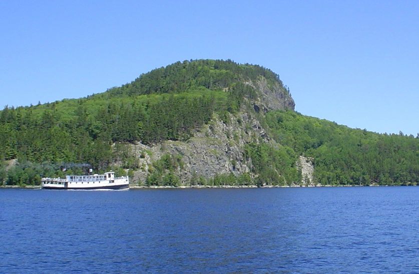
Mount Kineo State Park is not accessible by road. Maine's public lands guide says most summer visitors arrive by commercial boat shuttle from Rockwood, crossing about 0.8 miles of Moosehead Lake.
The guide also notes that visitors follow the shoreline path from the boat landing past private property to state lands. That distinction matters: The Oak Lodge is private and is not open for public stays, tours, events, or drop-in visits.
Access sequence
The Oak Lodge shares this access context as part of Kineo's larger story. It does not operate visitor services.
Confirm seasonal shuttle details before you go.
Cold water and sudden wind can change conditions quickly.
Move from the landing past private property toward state lands.
Match the hike to shuttle timing, weather, and daylight.
Trail map
Trail distances are summarized from Maine's Moosehead Lake Shoreline guide. The schematic highlights the main routes; the embedded map below gives a second reference point for planning.
About 0.9 miles to the summit from the Carriage Trail. Steep, ledgy, and dramatic.
About 1 mile to the summit from the Carriage Trail. A less steep route from the second intersection.
About 2.2 miles from the boat landing to Hardscrabble Point along the west shore.
About 1.9 miles from Hardscrabble Point to the summit, with a more gradual eastern ascent.
Safety and courtesy
Maine's guide warns that Moosehead Lake can be dangerous, with cold water and sudden winds. It also advises sturdy footwear, water, extra layers, caution near cliffs, and confirming shuttle times before hiking.
Please do not use this site as an invitation to visit the lodge property. Public access information here is for Mount Kineo State Park and the surrounding public landscape.